Words & photos: Mark Stevenson
In 1845 this part of Henconner Lane/Poplar Way was a bit like a Victorian version of an industrial estate as it was made up of shops, yards and a farm.
Across the way where Leeds Bacon is, there was a tannery – so it may have been a bit of a smelly place to live.

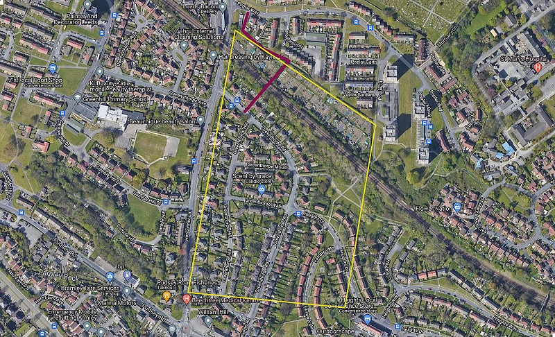
All the land you can see in the above picture (inside the yellow line) was owned by Greenup (no first name given, just ‘executors of Greenup’), he/she also owned the land that is now Longfield Drive and half the cricket pitch in Rodley.
The land Greenup owned in Bramley was occupied by Hannah Wilson (born 1781) and her two daughters Martha and Ann, who were both born in 1821 so may have been twins? Both Martha and Ann were stuff weavers.

I’m not sure if Hannah actually farmed the land she rented, as it does not give her occupation. With field names like Stack-Garth (a regional alternative of stack-yard, an enclosure close to a farm where hay, corn and the like might be stacked) and Far Pasture she may well have.

The footpath you can see in the above picture is part of the “at-risk footpaths” that need to be registered if you don’t want to lose them in the future. The railway tunnel dates from around the 1840s and has people’s names carved into it.

I assume the names are of local kids from the 60/70’s. Do you recognise your name?


I didn’t realise this footpath was at risk. The bridge is what used to be called an “Occupation bridge” to allow the landowner or farmer access to the land taken over by the railway company. The land where the Poplar, estate now stands was farmland prior to the 1960’s, rhubarb was a common crop in the area.
i lived in the last house before the bridge next to the tannery my family lived ther about a 100 years i lived ther from 1935 to 1963 and the farm land was nover worked