I don’t have much use for maps, I tend to just set off walking and hope for the best when I go out walking around Leeds, writes Mark Stevenson.
But that does not stop me appreciating the effort going in to making them and they are a useful research tool. With modern technology we can map the country in no time at all, but in the not too distant past it would take years.
The Ordnance Survey realised that the maps of the country needed updating as the country grew so did the need for more accurate maps.
On 18 April 1936, a group of surveyors gathered around a white concrete pillar in a field in Cold Ashby, Northamptonshire, and began the re-triangulation of Great Britain.
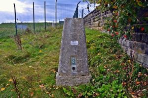
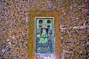
There used to be about 6,500 trig pillars, built by the early surveyors at OS.

Two I know of still remain in West Leeds one is on Leeds and Bradford Road in Whitecote which first appeared on the maps in the 1950s (pictured above).
The other is at Bramley Reservoir, although this one has been moved from one side of the Reservoir to the other again first appearing on the maps in the 1950s.

The mapping of the country using these pillars was so accurate that when it was done again using GPS they were only a few centimetres out.

____________
We encourage anyone living or working in West Leeds to use this website to tell their news. You can either use our Create an Article page, or e-mail us at news@westleedsdispatch.com.


There is a third one near Swinnow. https://www.geograph.org.uk/photo/431598